
ORaaS Visibilities Demo
Define your point of interest, input the satellite name and its Two Lines Element (TLE), click a button.
The satellite starts its run around the globe. When it is visible from the point, the path is highlighted.
You can add up to three satellites and three POIs to our demo.
Note that the input of a station coordinates is not needed to see the orbit of your satellite(s).
-
Quick start
- Click on the Start button. The input form is displayed above the viewer.
- Input the period of the simulation,
- Choose your point of interest (this step is optional).
- Input your satellite name, choose the color of its path,
- Paste the Two Lines TLE1 and TLE2 which define the orbit,
- Input the period of the simulation,
- ... Or click one button to populate the form with our examples: GPS, ISS or Astra.
- Click the Compute & Add to Viewer button.
Your satellite appears in the viewer, it is the beginning of the period.
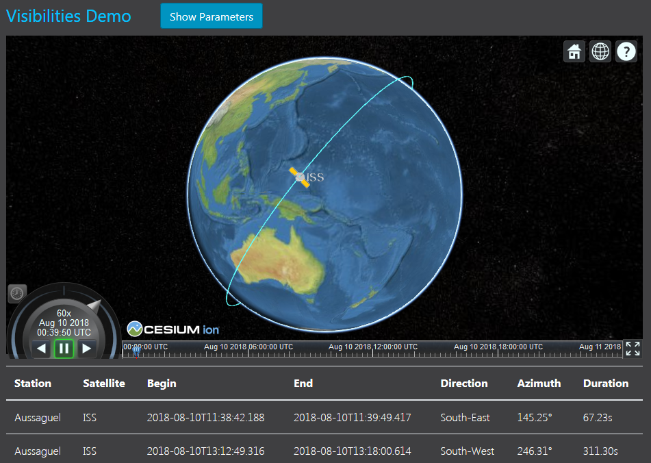
If you have input a POI location and that your satellite is visible from this point, the Visibilities button is enabled. Click it, a table is displayed below the viewer with the details of each visibility which occurs in the period: dates and duration, direction of the satellite at the beginning of the visibility.
A sample result might look like this.
Please note that you have to input a name for any satellite or POI, or it will not be taken into account for the computation.
-
-
-
ORaaS services
Our visibilities demo illustrates the propagation service published by ORaaS, with some orbital events computation. Details and the default values for the parameters can be found in our API documentation.